In this article
- 1What We’re Seeing in Panama
- 2Managing the Local Area: Knowing Where to Take Action
- 3Campus Management: Connecting the Site, Buildings, and Information
- 4A University Campus: Understanding the Systems That Keep Facilities Running
- 5First, Let’s Get to Know Each Other
- 6A First Conversation for Your Organization
We all rely on infrastructure. We work in buildings, walk through public spaces, and use services that depend on facilities and equipment.
As a user, think of a problem that disrupted your day: a leak, a closed-off space, or a service outage. What did you need to know to report the issue at that moment?
If you also manage a building or oversee infrastructure for a business or organization, the questions change: What information did you need to address the problem? How much time and effort did it take to find it, and what would have been different if it had been readily available?
The roof is leaking. The team needs to locate the affected area, identify the roofing system, check the warranty, and review previous repairs. While gathering that information, they also need to decide how to address the leak and keep the building operational.
Where would your team look for those records? Who could confirm they are up to date?
The warranty always seems to become essential on the very day no one remembers where they filed it.
These questions are my starting point for discussing BIM, GIS, and infrastructure management in Panama. Before we marry ourselves to a tool, let’s understand the needs of the people who will use it.
Think of the demo as a first date. It may be a little early to book the wedding venue.
The demo may sweep you off your feet. Then comes living with the data.
What We’re Seeing in Panama
As of October 2026, the initiatives I have learned about and the publicly documented cases I have reviewed show different ways of using digital information to understand and manage our built environment.
I’m interested in how that work carries through into day-to-day operations: Who updates the data? Who uses it? What decisions does it support?

The Esri Panama User Conference—CUE 2026—helped bring attention to initiatives that allow us to ask more specific questions.
Managing the Local Area: Knowing Where to Take Action
The Betania Community Board presented Betania 360, an initiative that combines reality capture, photogrammetry, and geographic information systems. Its geoportal organizes location-based information to support analysis and work planning across infrastructure, green spaces, and risk areas.
For infrastructure managers, this raises a practical question: Can we connect the location of our assets with the surrounding conditions that affect them?
Campus Management: Connecting the Site, Buildings, and Information
Ciudad del Saber announced progress on Campus Vivo, its digital twin lab. The organization describes it as an initiative that is beginning to bring together the site, its buildings, and their associated information to explore new ways to understand, plan, and manage the campus.
At this scale, the question I want to explore is: What information does the building management team need to share with the teams responsible for utility networks and outdoor spaces?
A University Campus: Understanding the Systems That Keep Facilities Running
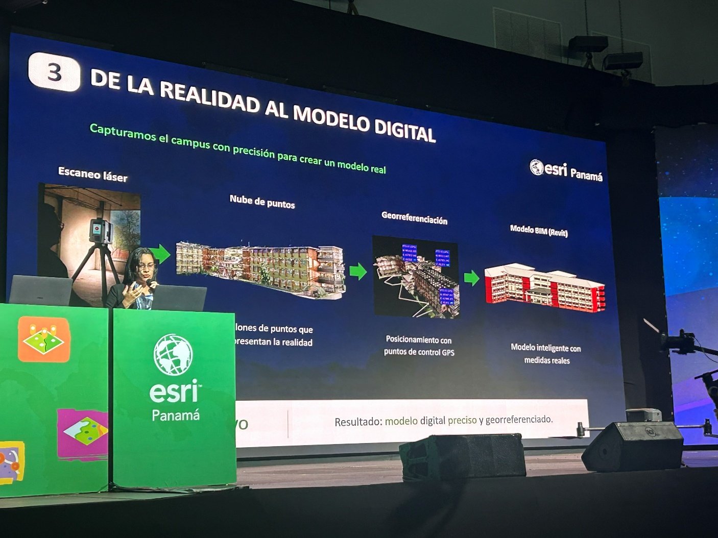
Another example is Smart Campus at the Universidad Tecnológica de Panamá (UTP), an initiative that caught my attention at CUE 2026.
UTP has a pilot project using indoor GIS to bring together, visualize, and analyze information about its campus and facilities. In January 2026, the university reported that Building No. 1 on its Víctor Levi Sasso Central Campus already had what it describes as a digital twin, incorporating survey data for the plumbing, electrical, air-conditioning, and telecommunications systems. The project involves ACRE, with support from Esri Panama.
This example brings us closer to the systems we need to understand when a failure occurs or when we need to plan work.
If we need to work on a building system tomorrow, can we locate it, identify the spaces it serves, and access the information we need to act?
These cases show progress at different scales and with different scopes. To understand their day-to-day value, we need to see how the data connects to operations and maintenance tasks.
First, Let’s Get to Know Each Other
Before selecting a tool, I suggest bringing the people who need the information to the table and asking:
- What task do you need to perform?
- What information do you need to do it?
- Where do you access that information, and how do you verify it is current?
- Who records the changes once the work is complete?
The answers help define what we expect from a model, a map, or a maintenance management system.
For example, locating a roof on a map can help identify an inspection area. To address a leak, we also need access to its maintenance history, documentation, and inspection findings.
This is the getting-to-know-you stage: understanding the work, the challenges, and the responsibilities before committing to a solution.
A First Conversation for Your Organization
Choose a recent maintenance or repair job and bring together the people involved. Walk through the information they needed, where they found it, and what they had to verify again.
Then identify one specific improvement: a data entry that needs updating, a document that needs to be linked to the asset, or a responsibility that needs to be clearly assigned.
If you use the facility, your experience matters too. Explain what happened, how it affected you, and what information you would have needed.
What information would have helped you respond more effectively during your most recent maintenance or repair job?
At ARCOpm, we can help you translate that need into asset information requirements for your project.
In the next article, I’ll share experiences from my work as a BIM Manager to explore another question: Who represents operations and maintenance needs during infrastructure design?